
A Bit About Me




Personal Overview
I am a quantitative ecologist at the Biodiversity Research Institute (BRI) in Portland, Maine, where I co-direct the Marine Mammal Program and lead the Antarctic Program. I completed my PhD in Ecology and Evolution at Stony Brook University in December 2024, working in the Lynch Lab for Quantitative Ecology on penguin and seal populations along the Antarctic Peninsula.
My work sits where field ecology, remote sensing, and statistics meet. I have surveyed moose habitat in the boreal forests of northern Minnesota, counted penguins from sailboats and drones in Antarctica, and run line transects for large mammals in the savannas of northern Kenya. The question underneath all of it is the same: how do we measure wildlife populations well enough, over large enough areas and long enough timescales, to understand how they respond to a changing environment? I answer it with satellite imagery, drones, acoustic recorders, animal tracking data, and Bayesian models that are honest about their uncertainty.
I care about open, reproducible science. I release code and data wherever I can, and I try to write methods and tutorials that are useful to someone who has never programmed before as well as to specialists.
Current Research Initiatives
My current work at BRI falls into four areas: offshore wind and birds, marine mammals, Antarctic seabirds and marine mammals, and grassland, savanna, and rangeland biodiversity monitoring in East Africa.
Offshore wind and birds. I lead the quantitative development of the Northern Gannet collision risk module of SCRAM 3, a stochastic collision risk model funded by the Bureau of Ocean Energy Management, which combines ship-based survey density surfaces with GPS tracking of flight behavior. I model Piping Plover offshore movement along the U.S. Atlantic coast with Bayesian state-space models. I also lead the design, field calibration, and analysis for the New Jersey Motus Wildlife Tracking Network expansion, including drone-based calibration of receiver stations.
Marine mammals from space. Working in collaboration with NOAA’s Northeast Fisheries Science Center, I lead BRI’s automated grey seal detection pipeline, which applies computer vision foundation models to very-high-resolution satellite imagery across breeding colonies in the Gulf of Maine, southern New England, and Atlantic Canada.
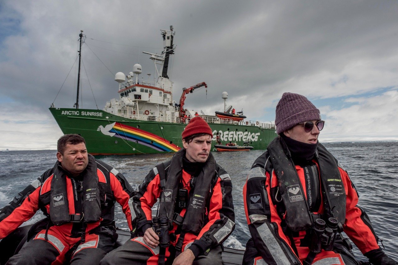
Antarctic seabirds and marine mammals. I continue work on seabirds and marine mammals in Antarctica, now as lead of BRI’s Antarctic Program. The sea ice work from my dissertation was published in Marine Ecology Progress Series in 2026 and shows that winter sea ice decline drives Gentoo Penguin population expansion along the western Antarctic Peninsula. I am also building deep learning classifiers for Antarctic seabird and seal vocalizations from a multi-year passive acoustic corpus, and developing acoustic methods for breeding phenology and community occupancy.
Grassland, savanna, and rangeland biodiversity monitoring. In East Africa I develop species distribution, habitat, and community analyses for birds and mammals, including multispecies occupancy models, to track biodiversity change across grassland, savanna, and rangeland landscapes. I pair these with satellite remote sensing workflows that characterize vegetation structure and condition across project areas in Kenya, Zambia, Uganda, and Tanzania.
Software and Tutorials
I release the tools and methods behind my research where I can. A few current ones:
landfall. An R package for site maps and colony records on Antarctic expeditions. It draws a relief map of the surroundings of any Antarctic site from Reference Elevation Model of Antarctica (REMA) terrain and Antarctic Digital Database (ADD) coastlines, and places a new penguin colony count against the site’s long-term record in MAPPPD, the Mapping Application for Penguin Populations and Projected Dynamics. Everything a trip needs is packed into a local folder beforehand, so the figures render with no network connection. Code on GitHub.
Harmonizing Antarctic Sea-Ice Datasets. A reproducible R tutorial for combining two satellite sea ice products that differ in resolution and time span into one continuous record. It rebuilds the harmonized western Antarctic Peninsula dataset behind Wethington and Lynch (2026) using a small neural network trained on the years the two products overlap, and it runs on a bundled sample so you can work through it in minutes. Read the tutorial or get the code on GitHub.
esme (Earth System Model Extract). An R package that attaches weather and astronomical covariates to timestamped point locations such as bird detections. It samples NOAA HRRR and ECMWF ERA5 by nearest grid cell with hourly interpolation and computes sun and moon covariates, and new datasets plug in through profiles. Code on GitHub.
wildrice. An R package for radio propagation coverage modeling for Motus wildlife tracking receiver stations. It combines the Longley-Rice Irregular Terrain Model, compiled to C++, with a lidar-derived surface model and directional antenna gain patterns to predict signal attenuation from every grid cell within about 17 km of a station. Developed at BRI for the calibration of the New Jersey Motus network. Code on GitHub.
Motus Terrestrial Calibration, New Jersey. The calibration framework for Motus receiver stations operating at 434 and 166 MHz. Drone-mounted transmitter surveys collect georeferenced signal strength measurements across New Jersey coastal habitats, which are compared against Longley-Rice predictions to estimate station-specific correction factors and detection volumes. Code on GitHub.
Technical Skills
Programming and Software Development: Python, R, SQL, Regular Expressions (Regexp), GitHub, Markdown, LATEX, High-Performance Computing (HPC), Amazon Web Services (AWS), Visual Studio Code, Google Earth Engine, ArcGIS Suite, QGIS, Trimble eCognition, Adobe Illustrator, Adobe InDesign, Final Cut Pro, Ableton Suite.
Machine Learning and Data Science: Machine Learning Algorithms, Bayesian Statistics, Convolutional Neural Networks (CNNs), Object-Based Image Analysis (OBIA), Random Forest Model, Data-Driven Research, Data Processing and Analysis, Spatial Data Analysis, Temporal Data Analysis, Geospatial Statistical Analysis, Image Classification, Change Detection, Population and Community Ecology.
Geospatial and Remote Sensing: Geographic Information Systems (GIS), Remote Sensing Techniques, Satellite Imagery Analysis (Landsat, Quickbird, Worldview, ICESat-2, MAXAR Worldview Legion, Planet constellations), Structure from Motion (SfM), Digital Elevation Models (DEMs), Orthorectification, Geospatial Visualization, Cartographic Product Development, RPAS (drone) survey design, execution and analysis.
Research and Analysis: Scientific Research, Ecosystem Dynamics, Climate Change Impacts, Ecological Monitoring, Resource Selection Patterns, Habitat Characteristics, Multi-Decadal Trend Analysis, Fine-Scale Sea Ice Feature Extraction, Habitat Suitability Modeling, Presence/Absence Investigations.
Project Management and Leadership: Project Design and Implementation, Pipeline Development, Supervision of Graduate and Undergraduate Researchers, Resource Allocation and Management, Data Curation and Quality Assessment, Workshop Facilitation, Interdisciplinary Team Collaboration, Field Operations Support.
Education
PhD, Ecology and Evolution, Stony Brook University (2024)
MA, Geographic Information Science, University of Minnesota (2019)
BA, Psychology, Augsburg University (2010)
Active Licenses and Certifications
Wilderness Medicine Institute
CPR Certification
Defibrillator Certification
Epinephrine Auto-injector Certification
Wilderness First Responder
National Outdoor Leadership School
Leave No Trace Certified Instructor
Federal Aviation Administration
FAA Certified UAS Pilot (175 flight hours)
International Maritime Organization
Standards of Training, Certification and Watchkeeping for Seafarers (STCW) Certification
