Cartographic and Science Visualization Products
Wall sheets and figures from my Antarctic work, prepared for GIS Day 2026 and drawn in R from open data: the Reference Elevation Model of Antarctica, the Antarctic Digital Database, the Composite Gazetteer of Antarctica, and the NOAA and NSIDC Sea Ice Index. The sea ice sheets were built with frazil, an open-source R package for Antarctic sea ice figures. Click any image to view it at full size.
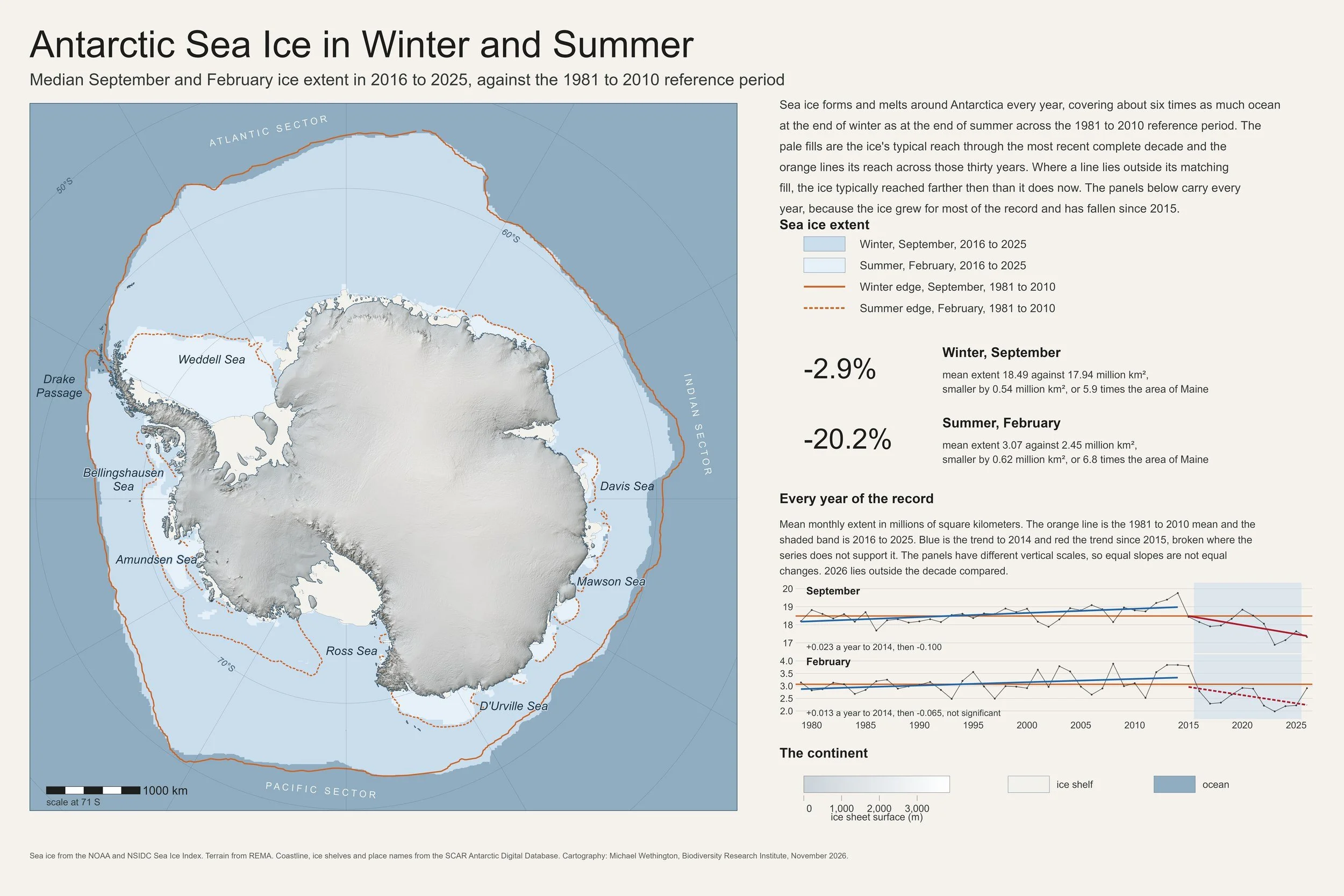
Antarctic sea ice extent: median September and February extent in 2016 to 2025 compared with the 1981 to 2010 reference period, with the continent drawn in relief from the Reference Elevation Model of Antarctica.
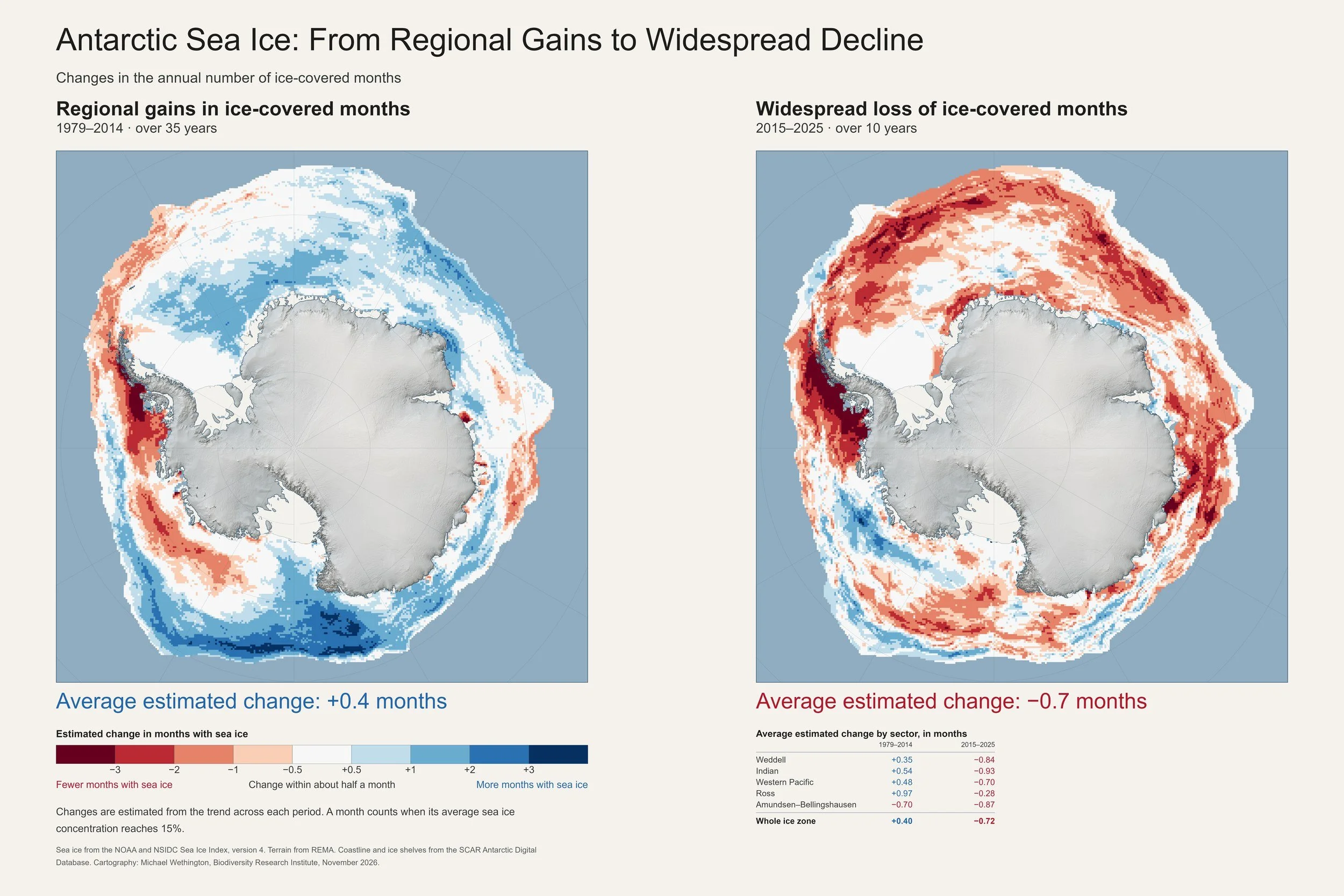
Change in Antarctic sea ice season length across the growth era (1979 to 2014) and the loss era (2015 to 2025). The earlier era moved ice between regions; since 2015 every sector has lost ice-covered months.
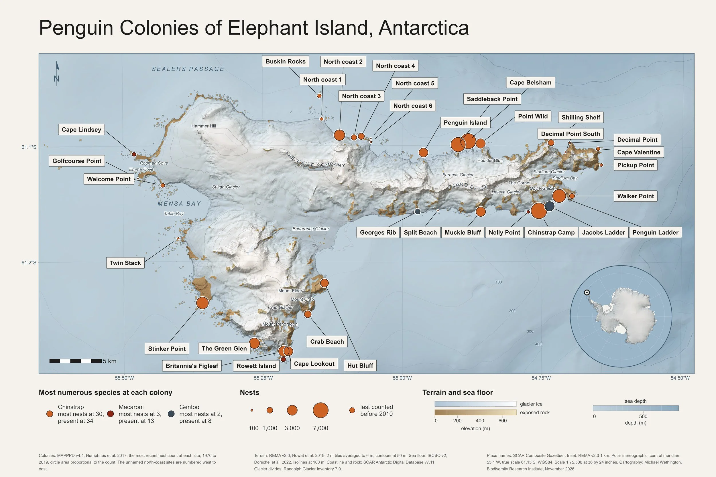
Elephant Island penguin abundance: the 35 surveyed penguin colonies of Elephant Island, South Shetland Islands, with each circle scaled to the most recent survey count at that site and colored by the dominant species, over terrain from the Reference Elevation Model of Antarctica.
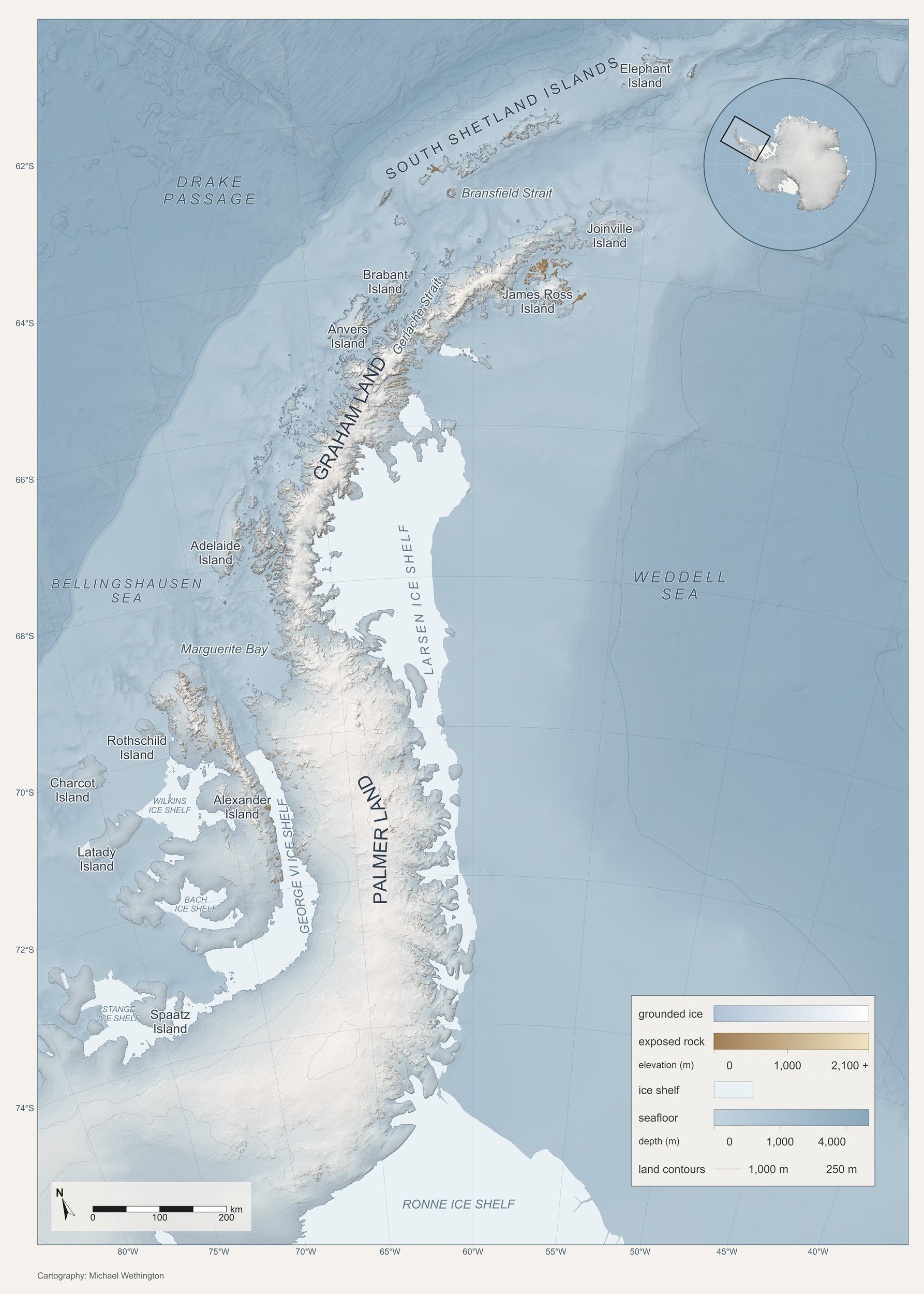
Antarctic Peninsula: a reference map of the Peninsula, extended south to the head of the Weddell Sea.